Simon Mitchell | Post-Hurricane Melissa flooding in Jamaica – an explanation
Loading article...
-
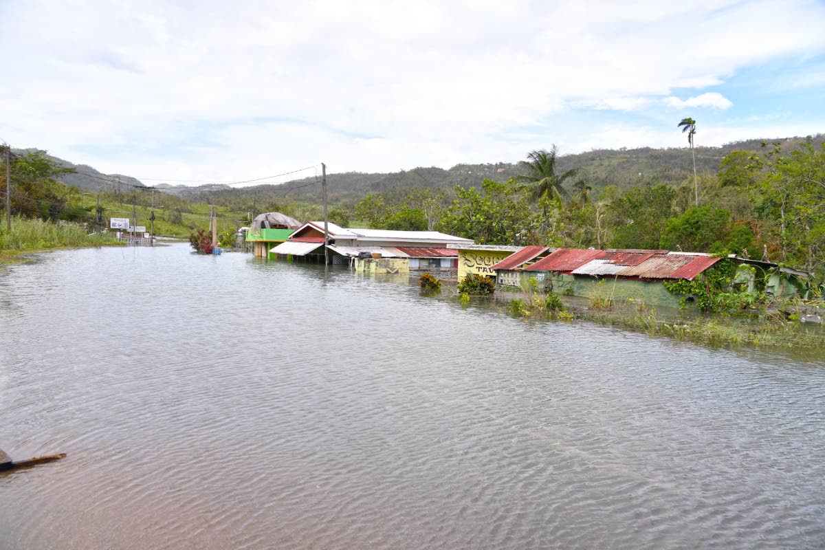 Rising water levels in Content in Williamsfield, Manchester, which inundated homes and business establishments.
-
 Simon Mitchell
There is a lot of news speculation about rising flood waters in areas such as Content and New Market, where flood waters have begun rising since the passage of Hurricane Melissa across the island in late October 2025. This is a natural occurrence and is due to the combination of rainfalls and flow rates of underground water.
We can use a simple two layer model for the geology of Jamaica – an upper limestone (part of the Yellow Limestone and the White Limestone) and a lower non-limestone (shales, sandstones and igneous rocks) layer. Limestone is composed of calcium carbonate (CaCO3) and this is dissolved by acids. Get a piece of limestone and put some vinegar on it – the limestone will fizz giving of carbon dioxide (CO2) as it dissolves.
In nature, there are two natural sources of acid – the decay of plants in soils and rain water. Rain water is slightly acidic because as the rain falls from the sky it takes in small amounts of CO2 and becomes weak carbonic acid. Rain water finds its way into the limestone along cracks and fissures (joints and faults) and slowly dissolves the adjacent limestone producing conduits along which rain water flows. This dissolution only occurs in the limestone and not in the rocks below. It takes thousands to millions of years for large fissures to form in the limestone and the end result is the karst topography with sink holes and residual hills (like Cockpit Country) that we see across large parts of Jamaica today.
Flooding associated with karst areas results from: high rainfall, geographically enclosed area (depressions) and an underground basin in the White Limestone (usually created by faulting of the limestones millions of years ago). We call such areas karst basins or karst drainage basins. When rain falls on the ground, it sinks into the limestone along the conduits and runs downslope (underground) into the underground karst basin. The flow into the basin is greater than the flow out of the basin due to the faulting. This causes the water table (depth to the top of the water) to rise in the basin, and if there is sufficient rain then the water level can rise until it meets the ground surface.
TAKES A WHILE
This does not happen immediately, but takes time as the water takes a while (days to weeks) to flow through the conduits (like flood waters passing down a river). The first areas to flood are the sink holes and with more rainwater these can over flow and merge to form a large lake in a geographically enclosed depression – an ephemeral karst lake (a lake that forms infrequently). Because the amount of rain water passing into the underground basin will gradually slow down over time, eventually the karst lake will stop rising and begin to fall. This may take weeks or months.
We can illustrate this by using a saucepan with a hole in the side (representing the basin and the hole the conduits out of the basin). If you put the pan under a tap and turn the water on gently, the water rises in the pan to the level of the hole and then flows out of the hole, but does not rise higher in the pan. If you turn the tap on more, the water rises above the hole (because insufficient water can escape from the hole). As the water level rises the pressure of water at the hole increases (this is what is called ‘head’) and the water passes through the hole at greater speed. An equilibrium may be reached between the flow in from the tap and the flow out through the hole, and the water level in the pan becomes stable. If you turn the tap on even more, the water level will rise and water will overflow the rim of the pan – this is like forming a karst lake.
The geology of Jamaica is actually very complex and there are numerous faults (some active and some inactive) that have produced many karst basins and karst lakes in different parts of the island. These include the Content area (Manchester), Moneague Lake (St Ann), the New Market and New River (Westmoreland), and the Duanvale area (Trelawny, which has a slightly different geology), among others. Some people will remember the last time some of these areas flooded.
CANNOT DO ANYTHING
Can we do anything about the flooding? No, these are natural systems and we cannot easily do anything to stop them. Even by bringing in large pumps, draining the lakes would be difficult because the water has to be pumped to outside of the karst basin. Because it takes time for the flood waters to rise, it also gives time to move people and their belongings away from areas that might flood.
Has bauxite mining increased the risks? Actually no. Bauxite occurs in natural sinkholes, so extracting the bauxite makes the sink holes deeper and wider. This actually increases the size of depression that will pond additional water, and these may fill (depending on the water table) reducing the amount of flooding elsewhere.
Are there any benefits from karst basins? Yes. As climate change drives changes in weather patterns and we see longer droughts, these basins offer the opportunity for careful exploitation of underground water during drought periods. It is therefore critical that when new water wells are dug that a proper geological record is made so that the geology can be understand. In this way, potential water supply can be better understood for the benefit of people that live around the basin.
Simon F. Mitchell holds a chair in Sedimentary Geology in the Department of Geography and Geology at The University of the West Indies. Send feedback to columns@gleanerjm.com